
of
of
of
Jabrayil district is situated in the south of the Azerbaijan Republic, on the Minor Caucasus Mountains. It borders with the Iran Islamic Republic in the south, Zangilan in the south-west, Gubadli in the west, Khojavend in the north, Fuzuli in the east.
Jabrayil granted administrative district status on August 8, 1930. Its territory is 1.05 thousand sq. km, a population of 74,5 thousand people by 2013. The district consisted of one administrative city centre (Jabrayil), 4 settlements, (Khalafli, Khudaferin, Gumlag, Mahmudlu) and 92 villages. The villages are Khubyarli, Khudaverdili, Imambaghi, Gurbantepe, Shahveledli, Yarehmedli, Balyand, Khalafli, Garajalli, Yukhari Merjanli, Boyuk Marjanli, Jojug Marjanli, Chereken, Efendiler, Papi, Dagh Tumas, Chelebiler, Garaghaj, Sofulu, Hajili, Huseynalilar, Kavdar, Mirek, Tulus, Horovlu, Chapand, Safarsha, Hovuslu, Isagli, Galacig, Doshulu, Mahmudlu, Yukhari Maralyan, Gazanzemi, Chullu, Dagh Mashanli, Asgerkhanli, Soyudlu, Gumlag, Derzili, Mestalibeyli, Guyjag, Nuzgar, Sheybey, Mashanli, Alikeykali, Mehdili, Chakhirli, Minbashili. Aghtepe, Dash Veyselli, Sedi, Sarijalli, Emirvarli, Mezre, Yukhari Mezre, Sirik, Ashaghi Sirik, Molla Hasanli, Khanaghabulag, Shahvelli, Goyerchin Veysalli, Haji Isagli, Goshabulag, Govshudlu, Niyazgulular, Tinli, Shukurbeyli, Dejel, Fughanli, Hasangaydi, Shikhaliaghali, Gishlag, Karkhulu, Tatar, Ashaghi Maralyan, Shikhlar, Jafarabad, Kurdler, Dashkesen, Yukhari Nusus, Suleymanli, Niftalilar, Yanarkhach, Gushchular, Kechel Memmedli, Garar, Soltanli, Ashig Melikli, Nusus.
The name of Jabrayil was taken from the name of the village Jabrayil that was the centre of the district. Father Jabrayil, who was the founder of the village Jabrayil, was one of the closes of the ruler by the name Sultan Ahmed who lived in the VIII century and the territories between Zuyaret Mountain and the river Araz belonged to Father Jabrayil and his sons.
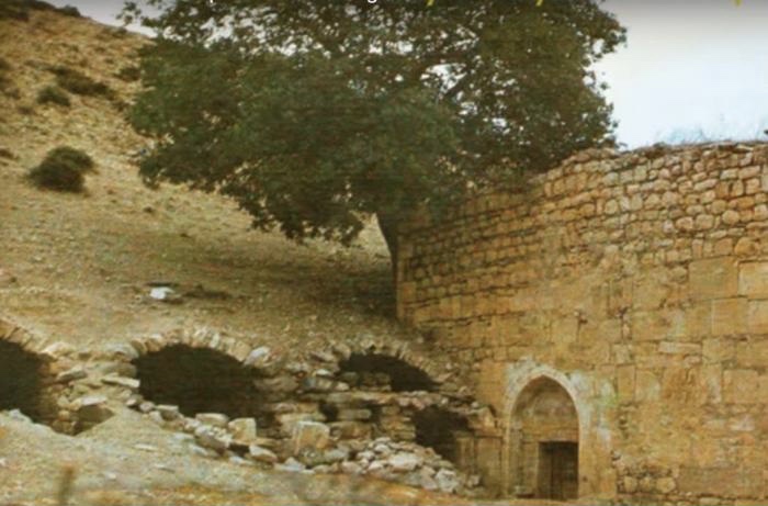
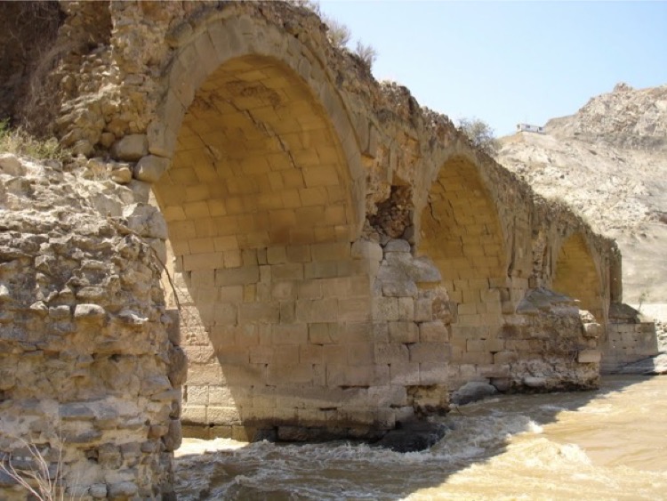
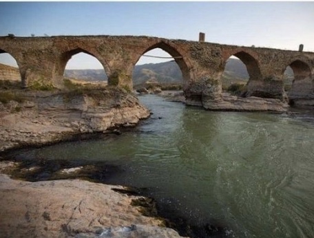
One of the unique architectural monuments of Azerbaijan and the Near East, which played a key role in the development of trade from India to the Near East and up to Russia and Western Europe, was located in the territory of Jabrayil district: The Khudafarin bridges on the Araz River. The famous Khudaferin bridges across the Araz River that are located between Kumlah and Khudaferin (Khodaafarin) settlements could be served as a symbol of Jabrayil. These distinguished bridges are ancient architectural monuments and shreds of evidence of Azerbaijan’s historical past.
The territory of the Jabrayil district is rich with cement, marble, limestone, and other building materials. It is also known that there are iron-ore and oil deposits there. The people in Jabrayil were mainly engaged in vine growing, grain growing, silkworm breeding, and cattle breeding. Science, culture, education highly developed there. 92 doctors, 423 nurses worked in 510-beds’ hospitals. More than 1660 teachers were working at 72 schools, 3 musical schools, 12 culture houses, 32 clubs, 10 cultural tents, auto clubs, 78 libraries, one museum, and 508 cultural employees used to work in those enterprises. There were over 20 thousand exhibits in the regional History-Ethnography Museum, 8 industrial enterprises, 42 collective farms, livestock fattening complex, poultry farm functioned in the district.
An underground water-supply system that was formed in Azerbaijan in I century was widely used in Jabrayil. 118 underground water-supplies out of 813 in Azerbaijan are in this district. There were more than 360 ice-cold springs rich with natural minerals. Two large irrigation canals – “Teymur Guliyev” and “Maralyan” canals – in the district provided the rapid development of agriculture. There was a 4,039 ha protective forest-belt, 58.585 ha sowing area, 1079 ha garden area there.
Carpet-weaving in Jabrayil (there is also a separate carpet school in Jabrayil) was famous with pile carpets named “Gasımusaghi”, “Kurd”, “Garagoyunlu”, “Behmenli”, pileless carpets like carpet set, sackcloth (horse-cloth), holdall, saddlebag, verni, asmalig (suitable for hanging) mats, rugs, palas, farmash, kilim and jejim.
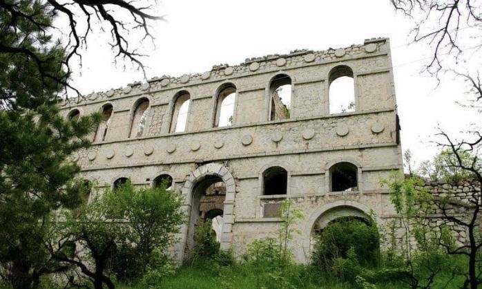
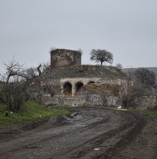
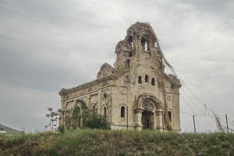
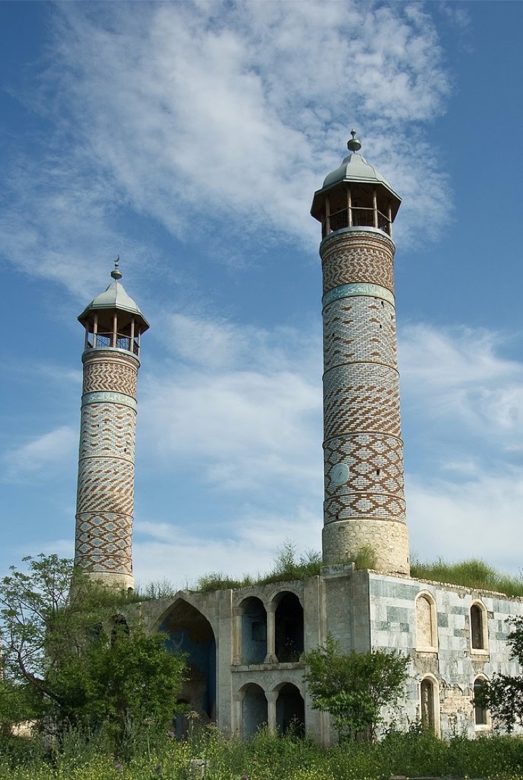
The territory of Jabrail is rich with material and cultural monuments. There are also a lot of other archeological and architectural monuments on the territory of the district. The list of architectural monuments could be continued with the flat tomb of the 13th -14th centuries in Dagh Tumas village, the project for the restoration of which was left uncompleted because of the Garabagh war; the round tomb of Salap ibn Giyasaddin of the 14th century in Shikhlar village; the mosque complex built by Mahammad ibn Haji Garaman Ahmadli of the I7th century in Chalabilar village, which was restored in 1990; the Sultan Majid hamam of the 18th century in Jabrayil town; and the round and octagonal tombs of the 17th century in Khubyarli village, the latter of which was restored in 1991. Jabrayil was also rich with mosques like those in the Papi, Dashkasan, Suleymanli, and Mazra villages, the first two of which were restored in 1991.
Like other occupied territories of Azerbaijan, Jabrayil could also be proud of its ancient history. Archeological monuments like the Palace of Cyclops dating back to the Cretaceous period in Dagh Tumas village, the Imangazantapa and Shikhlar mounds in Shikhlar village, the Niftali mounds in Niftalilar village, the Masjidtapa mound in Galajig village, the Gishlag mounds and residential area in Gishlag village, the Karkhulu mounds and residential area in Karkhulu village, the Jangulu and Gumtapa mounds in the north-west of Mahmudlu village, the Hovuslu mounds in Hovuslu village and the Toraghaytapa residential area in Shukurbayli village, all dating back to the Bronze and Iron Ages, were evidence of this.
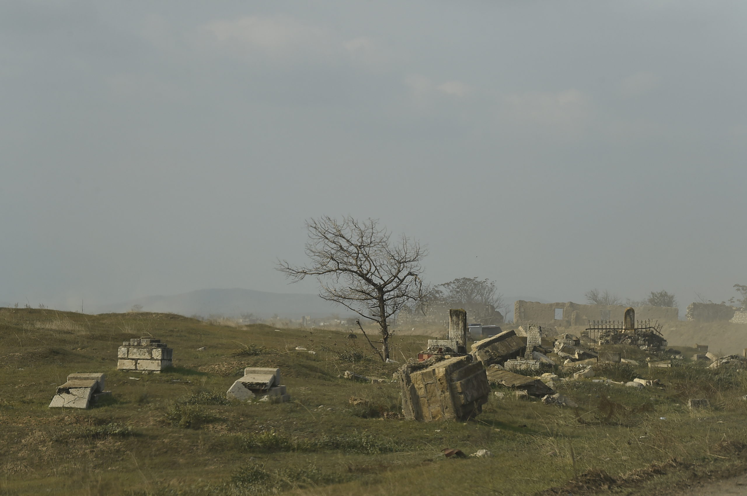
In addition to this list, the cemeteries of the Middle Ages between the Chalabilar and Dagh Tumas villages, in Sirik village, in the Khubyarli and Karkhulu Octagonal tomb, in Khubyarli village, on the Diridagh Mountain, and various stone sheep figures and decorative stones bore testimony to the fact that Jabrayil’s territory had continuously been a residential area.
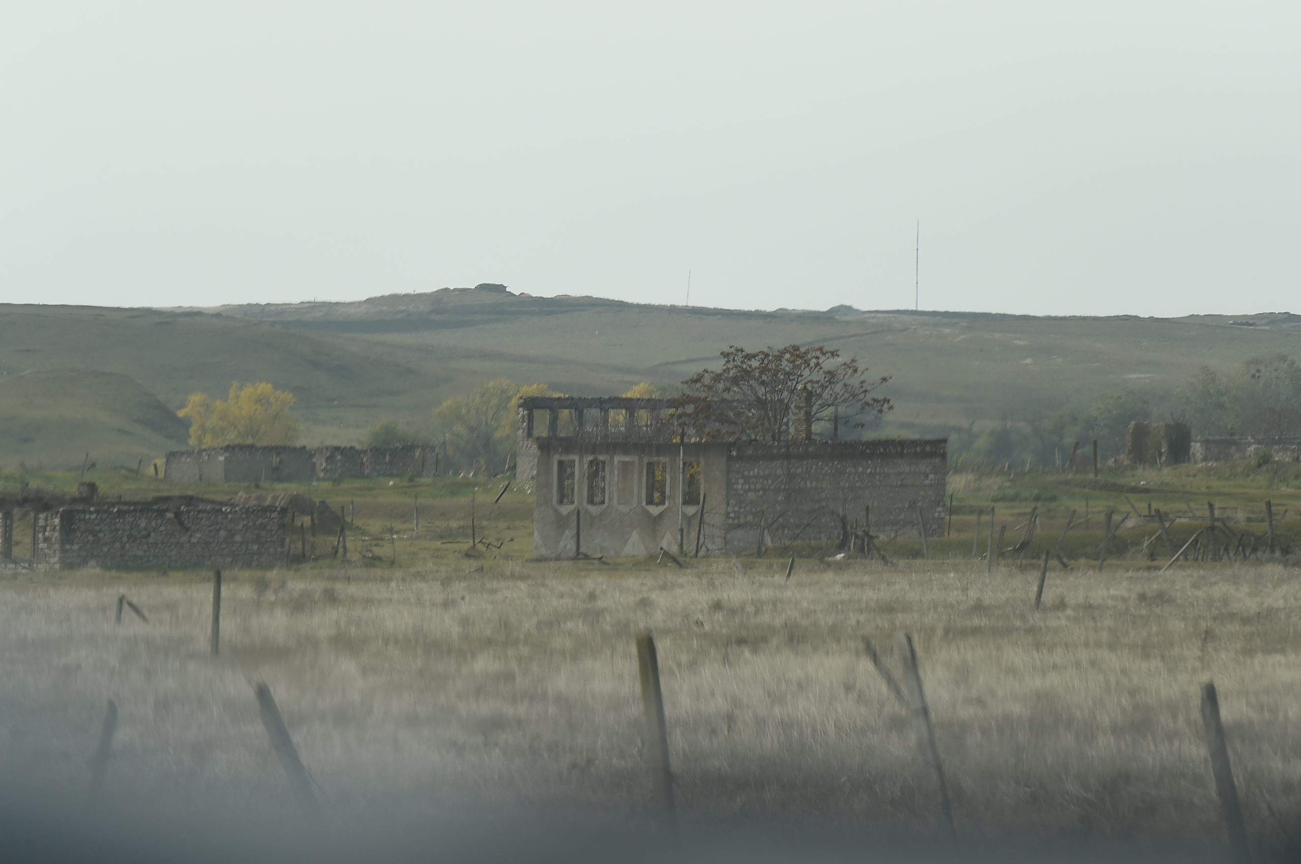
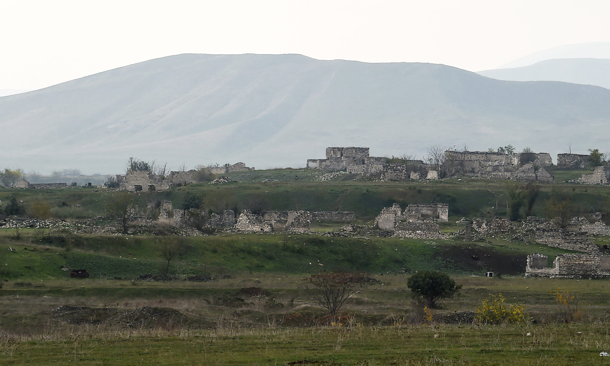
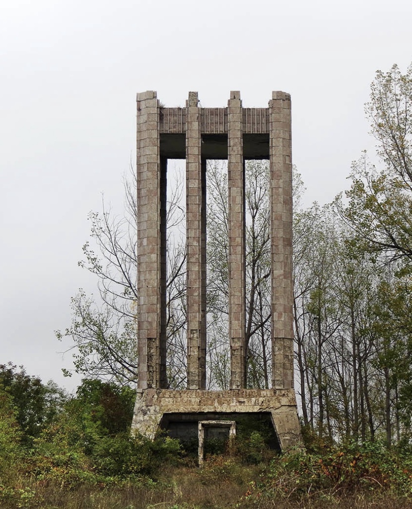
Jabrayil was occupied on August 23, 1993, by the armed forces of Armenia. The district with 1050 square km area, 72 secondary schools, 8 hospitals, 5 mosques, 2 museums, 120 historic monuments, 149 cultural centers, about 100 villages remained in the area occupied and destroyed by the Armenians. During the Karabakh War 362 people became martyrs, 149 civilians became invalids, and 6 people became National Heroes of Azerbaijan from Jabrayil.
On October 4, 2020, the Glorious Army of Azerbaijan ended the 27-year Armenian occupation of the city of Jabrayil.


Qaragol Interrepublics State Reserve was set up with the decision of the Council of Ministers dated November17, 1987. Garagol State …
The idea of establishing Aghdam Bread Museum, which is considered to be the second in the world after the Zurich …
The Khurshudbanu Natavan’s House is a historical and architectural monument of the 18th century located in the city of Shusha. …
Museum Mausoleum Complex of Molla Panah Vagif is located in Shusha, Azerbaijan. It was built in honor of Molla Panah …
Garghabazar Caravanserai was built in 1681 at the hillside, in the center of Garghabazar village of Fuzuli district, 8 km …
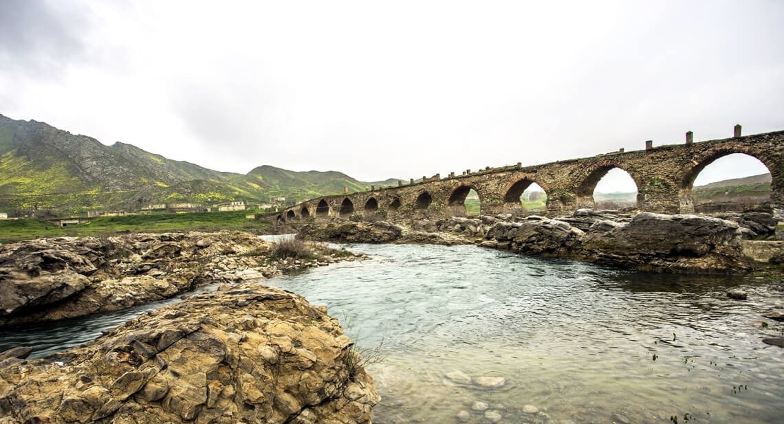
The Bridge belongs to the Arran architecture school. The first written source that mentioned the 15-arched Khudafarin Bridge belongs to …
Armenia’s vandalism in Nagorno-Karabakh and seven surrounding regions affected not only the historical, cultural, and religious heritage of Islam but …

Jabrayil History-Ethnography Museum has been operating since 1953. Archaeological and ethnographic materials belonging to the history of the region, textiles, …

Khudavang, or Dedeveng, Monastery Complex is located in the Vang village of Kalbajar District, on the left bank of Tartar …
“The 19th century Aghdam Juma Mosque is perhaps the only structure that has withstood the years of neglect since the …