
of
of
of
The Kalbajar district, with more than 4 000 plants, numerous gorges, hills, slopes, rocks, more than 30 000 cool, 17 hot, and more than 400 acid waters, gold, quicksilver, obsidian, and marble fields, was in itself a big monument. Another attraction of Kalbajar were the drawings engraved on the rocks of the Ayichyngyly and Parichyngyl Mountains, on the banks of Garagol and Zalkha Lakes. These were registered in 1966 and have been studied since 1976. Most of the more than 3.500 rock drawings registered here were found at an altitude of 3 000 m above Sea level. In these drawings with original decoration, artistic value, and topical diversity, one could find depictions of the plowing of a field with Kalbajar town a primitive plow, threshing of grain, hunting and religious ceremony scenes, deer, mountain goats, wolves, leopards, and others. These rock paintings, most of which dated back to the Early Bronze Age, differed from each other in size, composition, and drawing technique. At the end of the Late Bronze Age, more complex compositions appeared.
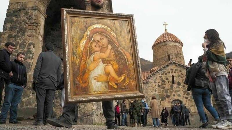
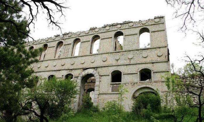
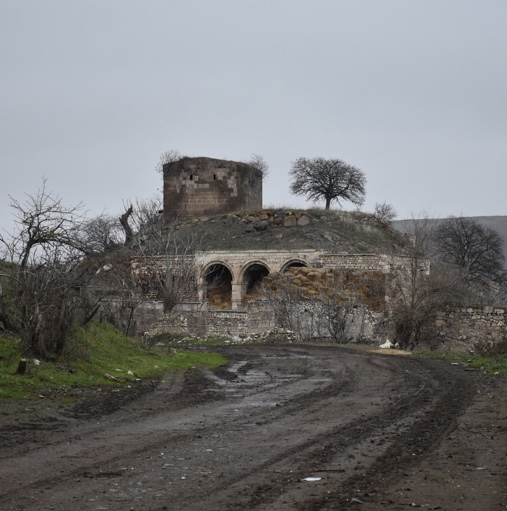
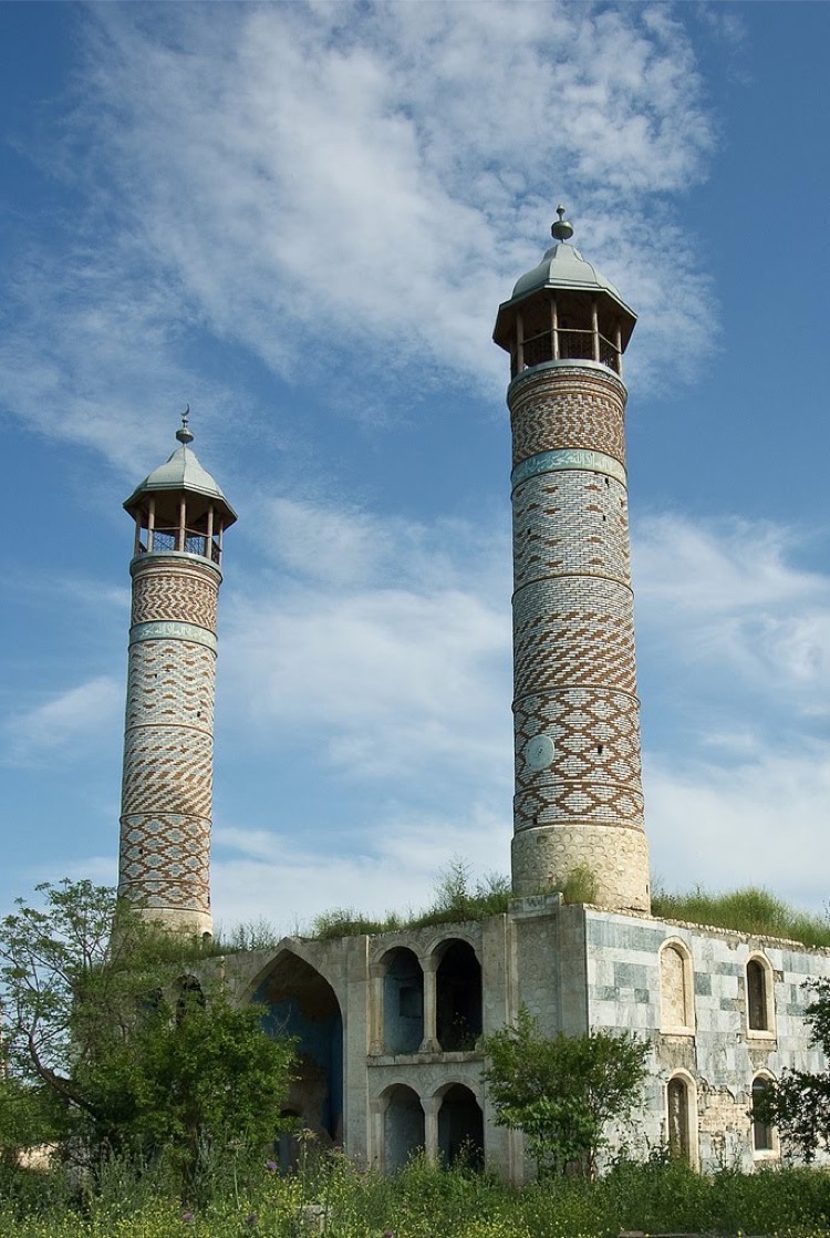
Apart from being an ancient residential area, Kalbajar’s territory was the center of the Khachyn entity, raised after the collapse of Caucasian Albania in the 12th-15th centuries. It is not surprising that one could find the most famous Albanian cloister complexes like Khudavang, Ganjasar, Khatiravang, and Saint Jacob in this area.
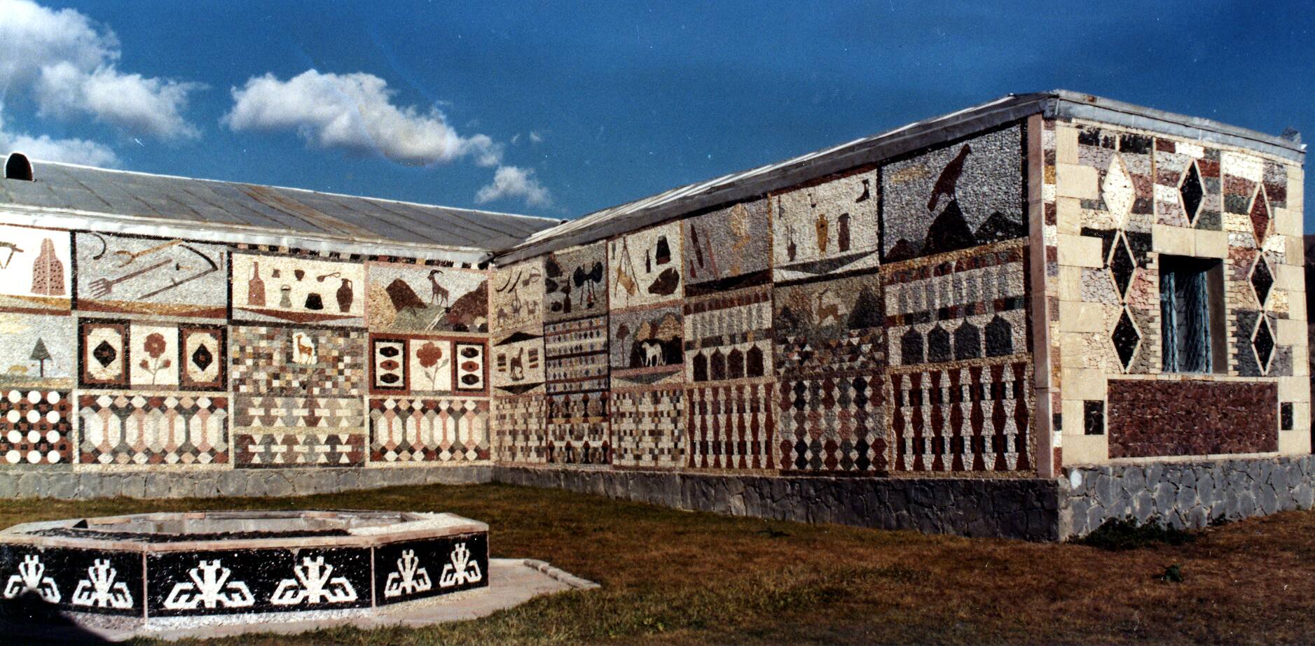
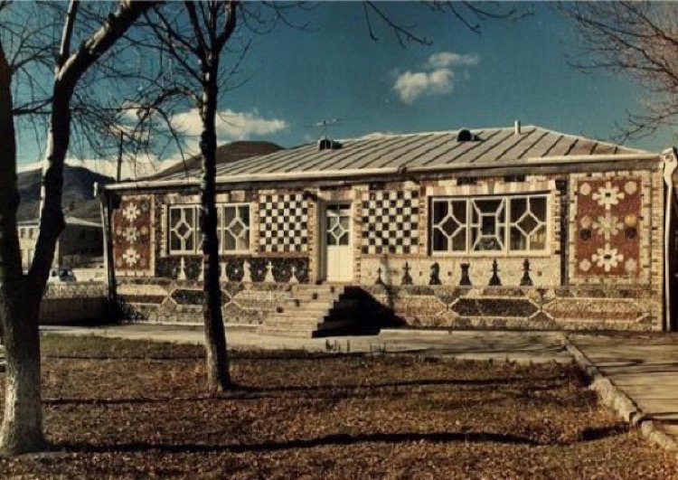
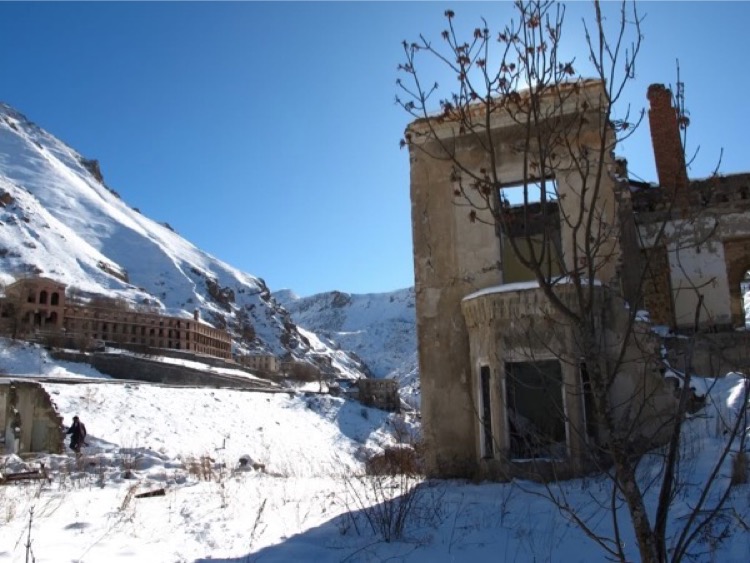
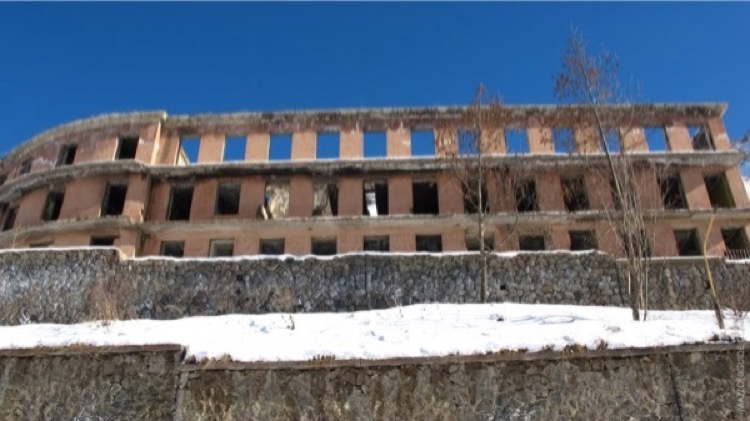
As for other monuments, one can list, among others, the Albanian temples of the 10th-13th centuries in Gozlu, Chormanli, Chyldyran, Bazarkand, Hasanriz, mosques in Otagli and Bashlybel, and castles in Ganlykand, Galaboyun, Vangli villages. However, there was one monument in Kalbajar, through which it was possible to make an excursion to the history of this area from ancient times up to the occupation by the Armenians. This was the Kalbajar Museum of History with an area of more than 900 sq.m, being the most attractive and fascinating among those of Karabakh.
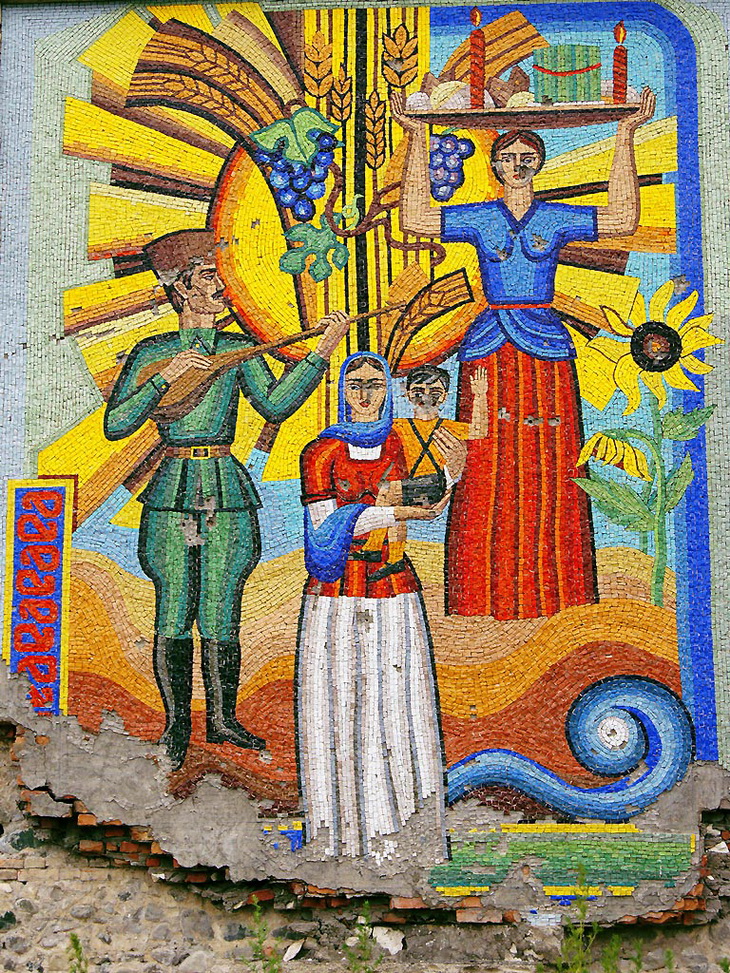
The district of Kalbajar was granted an administrative district status of the Republic of Azerbaijan on August 8, 1930. It is situated in the central part of the Minor Caucasus. It borders with the Republic of Armenia in the west, Dashkesen, Goygol, Terter districts in the north-east, Aghdam, Khojali in the east, Lachin district in the south. Its territory is 3054 km2. There was one district centre, one urban-type settlement, and 145 villages. About 20 villages of the Aghdara district were included in Kalbajar administrative division.
The villages of Kalbajar district are: Abdullaushaghi, Aghyatag, Fatallar, Moz, Mozgarachanli, Aghjakend, Orujlu, Tezekend, Zaghalar, Aghdaban, Baghirli, Chaygovushan, Almalig, Boyukduz, Lachin, Ashaghi Ayrim, Boyagli, Yukhari Ayrım, Baghlipeye, Veng, Bashlibel, Alirzalar, Chovdar, Khallanli, Shahkerem, Jomerd, Garaguney, Najafali, Piriler, Chaykend, Kendyeri, Gasimlar, Mishni, Rehimli, Chepli, Zulfugarli, Cherekdar, Childiran, Turkeshevend, Galaboyun, Garakhanchalli, Yanshagbine, Alolar, Armudlu, Bezirkhana, Hajimalilar, İlyaslar, Devedashi, Mehmana, Chirag, Mammadsefi, Tovledere, Dalghilijli, Barmagbine, Deregishlag, Otagli, Otgishlag, Dashbulag, Alchali, Allikend, Boyur, Demirchidam, Ganlikend, Bazarkend, Dovshanli, Hayad, Esrik, Chobangerehmez, Chorman, Tirkeshevend, Guneshli, Alchali, Nebiler, Hajikend, Bashkend, Heyvali, Yayiji, Hasanriz, Istibulag, Aghdash, Goydere, Keshdek, Kəremli, Kolatagh, Damghali, Gamishli, Baghirsag, Kechiligaya, Zergulu, Vengli, Zallar, Hasanlar, Zeylik, Kaha, Hopurlu, Gazikhanli, Orta Garachanli, Ashaghi Garachanli, Bash Garachanli, Kholazay, Imanbinesi, Tatlar, Gilınjlı, Alchali, Guzeychikin, Gizilgaya, Yukhari Oratagh, Chopurlu, Gozlu, Gozlukorpu, Lev, Merdgimek, Aghgaya, Birinji Milli, Ikinji Milli, Uchunju Milli, Mollabayramli, Nadirkhanli, Narinjlar, Saridash, Guneypeyə, Seyidler, Jemilli, Susuzlug, Gasimbinesi, Shaplar, Mammadushaghi, Ashaghi Shurtan, Orta Shurtan, Soyugbulag, Yukhari Shurtan, Takhtabashi, Yenikend, Tekegaya, Babashlar, Bozlu, Chormanli, Garaguney, Yanshag, Yellije, Tekdam, Zar, Sheyinli, Zivel, Shahmansurlu.
For 2013 the population of the Kalbajar district was 85,5 thousand people. 98% of the population made Azerbaijanis, the rest 2% the Russians, the Kurds from Iran, and other nationalities. The etymology of the word “Kalbajar” was taken from the Turkic origin that means “fortress on the river” (the initial form was “Kevlicher”). “Kevli” means “over the river”, “cher jer” means “fortress”.
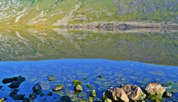
The surface is mountainous (Murovdagh, Shahdagh, East Sevan (Sevan), Vardenis, Mikhtoken, a part of the Karabakh chain and Karabakh plateau). Jamish Mountain is the highest peak (3724 m) and Dalidagh (3616 m). Jurassic, Cretaceous, Palaeogene, Neogene, and anthropogenic sedimentary, volcanic-sedimentary, and volcanic rocks spread in the area. The longest river of the district is the River Tartar, its tributaries (the Lev River, the Tutguncay River, etc.) and the source of the River Bazarchay is in the territory of Kalbajar district. In the central and northern part, broad-leaved forests, forest-steppe vegetation, in the high and partly high mountains alpine and sub-alpine meadows cover a large area. The total area of the forests is 32774 hectares. Mountain goats, brown bear, wild boar, rocky place squirrel, eagles, etc. enriches its fauna.
Kalbajar is located approximately 450 km west from Baku, on the Barda – Istisu (Kalbajar) motorway, on the bank of the Tartar River, on the cliffs.
There were district departments of State Security Committee of Republic Consumer-technical Agriculture, household service combinat, a station of sanitary-epidemiological, 2 secondary schools, music school, cultural center, 2 mass libraries, central hospital, polyclinic, cinema, maternity hospital, large trade, industrial institutions. Kalbajar is located on the mountain plain and it is in the foothills of mountains around it.
The heaven of Azerbaijan Kalbajar can be named rosary. It has more than 30 thousand springs with guests in all seasons of the year and it is a museum of nature. There are more than 4 thousand kinds of plants and 200 of them are used in treatment. As a Land of rich forests, Kalbajar owns hundreds of mineral springs. Istisu’s fame about curing every illness, a fancy of cloudy and misty Murov, Dalidag’s many guests on its hills, and its rosary of flowers are known to everyone. And so for that reason, father of geology of Caucasus Avix noted about Kalbajar: “The person who has never seen Tartar valley only then can be astonished in front of Switzerland”.
Treatment zones with mineral water fields, which gave popularity to Kalbajar such as Yukhari Istisu, Ashagi Istisu, Keshdek, Garasu, Mozchay, Bagirsag, Gotorsu are under occupation.
One of the gifts that Kalbajar possesses is Istisu and the chain of hills on the west of the district. Academic and scientist of Azerbaijan nature Mirali Gashgay said: “Istisu Mineral spring is the gift of nature. For the chemical consistency and physical features Istisu is the same with Karlovy-Vari waters (Czech Republic) and is unique for its some traits”. The most eminent scientist of that time Karstenski highly appreciated curing importance of those mineral waters in Istisu and he indicated that land as a place, which can bring popularity to not only Azerbaijan and USSR but also to the world. The heat of Istisu waters is 58,8 0C. 1 liter of water is rich in minerals such as lithium, bromine, iodine, arsenic, phosphorus, zink, med, nickel, magnesium, iron, weighing 6,7 grams. One of the springs wells out the fountain with a height of 8 meters. According to statistics each year 3 bln 963 mln liters of water come out from Istisu springs. Water filling fabrics had used only 22 mln of this water. Istisu Mineral springs appeared as a result of bulging and crack after the earthquake happened in 1138. The water of Istisu is hyperthermal, carbonic and there are substances such as hydrocarbon-chloride-sulfate-natrium in it. Istisu Mineral water is comprised of 12 active springs. It is situated in Kalbajar district and distinctive for its opportune gas and chemical consistency, high temperature, and natural resources. This water can be used for healing both interior and exterior ailments. 80 big resorts and a Mineral water filling factory were built in the spring. That factory had been producing 800 thousand liters of water every day. Sanatories were very important during the former USSR that functioned in the Istisu. 50 thousand people were cured and rested there each year. This spring is one of the natural resources bringing the highest amount of income to the district’s budget. A mass amount of money is spent on drilling oil. They also benefit from the assistance of foreign companies. The annual flow of Istisu is 600 mln liters. But only 10 % of this water was utilized. Tourists from many countries came to seek a cure in Istisu, which was considered more curative than Karlovu Vari in the Czech Republic.
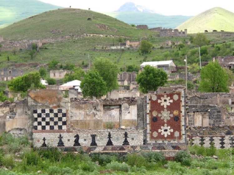
On April 2, 1993, Armenian aggressors occupied Kalbajar. As a result of the invasion more than 54 thousand settlers were displaced, 321 were held hostages, 511 were brutally killed, 97 schools, 9 kindergartens, 116 libraries, 43 clubs, 42 cultural centers, Museum of history, 9 hospitals, 75 medical stations, 23 ambulatories, 9 chemist’s, hundreds of administrative buildings, thousands of flats, 100 thousand cattle, 500 thousand sheep, hundreds of cars and machines were ravaged and billions of wealth of district were carried to Armenia.
As a result of the occupation of Kalbajar district, which is located outside of Nagorno-Karabakh, its population was lynched and displaced from their motherlands.
At its 3205th meeting, the UN Security Council adopted resolution 822 after the occupation of Kalbajar. The resolution demanded immediate withdrawal of all occupying forces from Kalbajar.
As the result of the trilateral peace agreement between Russia, Azerbaijan, and Armenia that was signed on November 10, 2020, for ending the Second Nagorno-Karabakh War, the Kalbajar district was liberated from the Armenian occupation on November 25, 2020.
“Resolution 822 (1993) Adopted by the Security Council at its 3205th meeting”, Karabakh in 99 questions. https://karabakh99.com/2020/11/08/resolution-822-1993-adopted-by-the-security-council-at-its-3205th-meeting/.


Qaragol Interrepublics State Reserve was set up with the decision of the Council of Ministers dated November17, 1987. Garagol State …
The idea of establishing Aghdam Bread Museum, which is considered to be the second in the world after the Zurich …
The Khurshudbanu Natavan’s House is a historical and architectural monument of the 18th century located in the city of Shusha. …
Museum Mausoleum Complex of Molla Panah Vagif is located in Shusha, Azerbaijan. It was built in honor of Molla Panah …
Garghabazar Caravanserai was built in 1681 at the hillside, in the center of Garghabazar village of Fuzuli district, 8 km …
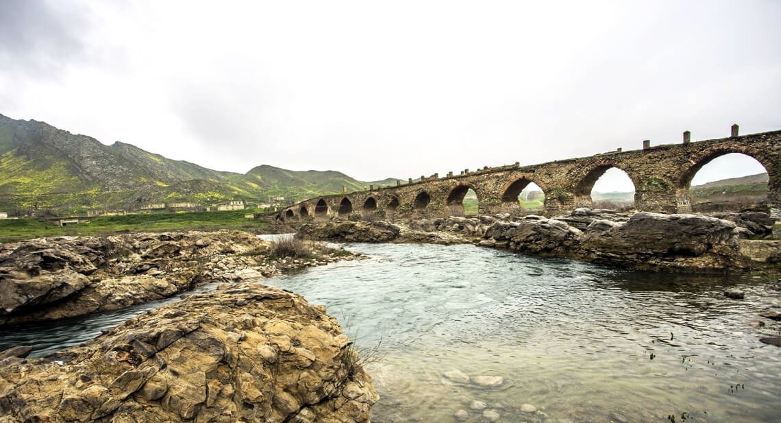
The Bridge belongs to the Arran architecture school. The first written source that mentioned the 15-arched Khudafarin Bridge belongs to …
Armenia’s vandalism in Nagorno-Karabakh and seven surrounding regions affected not only the historical, cultural, and religious heritage of Islam but …

Jabrayil History-Ethnography Museum has been operating since 1953. Archaeological and ethnographic materials belonging to the history of the region, textiles, …

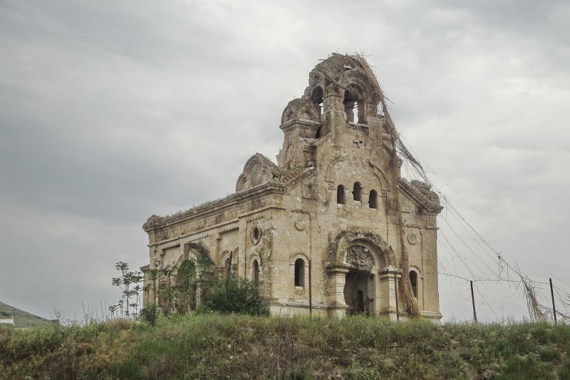
Khudavang, or Dedeveng, Monastery Complex is located in the Vang village of Kalbajar District, on the left bank of Tartar …
“The 19th century Aghdam Juma Mosque is perhaps the only structure that has withstood the years of neglect since the …