
of
of
of
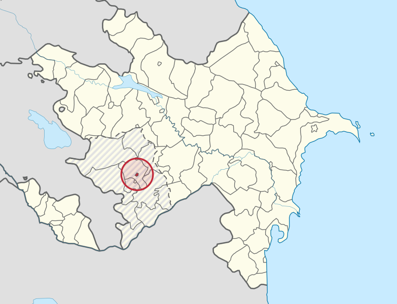
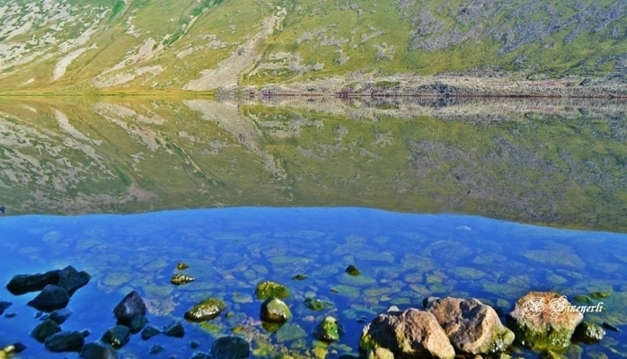
Khankendi is located on the Gargar River, at the eastern foot of the Caucasus range. Khankendi borders Kalbajar, Tartar, Aghdere, Aghdam in the north, Shusha in the south, Khojavend in the east, Lachin in the west, and in the centre it is surrounded by Khojali and Askeran districts.
Administratively, Khankendi combines one city (Khankendi) and one settlement (Karkijahan). It was the capital of Nagorno-Karabakh Autonomous Oblast. Its territory is 8.8 km2 with 55.5 thousand populations by 2013. The city of Khankendi was occupied by Armenian armed forces on December 28, 1991.
Being relatively young, Khankendi differs from other Azerbaijan cities. According to the archive records, the city was founded at the end of the XVIII century as a resting place of the Karabakh khans. To create a maximum condition for khans ‘activities, the city was settled at the foot of the mountain, in a 10- kilometers distance from Panahabad (now Shusha), the capital city of the Khanate. In the first years, only khan’s family and relatives lived in the settlement, that’s why it was known as “Khanin kendi” (Khan’s village) among local people. After a short time, it was called Khankendi. One reason why Ibrahimkhalil Khan chose Khankendi as his estate (mansion) was the suitable natural and geographical location of the village. The presence of a river in the upper part of the village, the thick forests around it affected the choice. Mirza Jamal Javanshir thus wrote that “six mansions (palaces) were left by the late Ibrahimkhalil Khan. One of them is Khan Bagi (Khan Garden) that is situated a short distance from Shusha”.
After the Karabakh Khanate was occupied by Tsarist Russia in 1805, the Tsarist Empire began to use Khankendi as a military camp. When the Karabakh Khanate was abolished in 1822, the Tsarist Empire’s military garrison was based permanently in Khankendi and the hospital, military barracks, church, and other administrative buildings were built there. From then on, Armenians who accepted the patronage of the Tsarist Empire began to settle in Khankendi.
After Azerbaijan was occupied by the Red Army in April 1920, Armenia’s territorial claims against Azerbaijan took on a new form. The pro-Armenian policy of Sergei Mironovich Kirov, First Secretary of the Central Committee of the Communist Party of Azerbaijan from 1921 to 1925, inspired Armenia. The Kavbureau CC RCP (b) (Caucasus Bureau of the Central Committee of the Russian Communist Party of the Bolsheviks) therefore decided to give Nagorno-Karabakh autonomous status within the Azerbaijan SSR. On July 7, 1923, the Azerbaijan Central Executive Soviet Committee passed a decree authorizing the Nagorno-Karabakh Autonomous Oblast (NKAO) to be established as a constituent part of the Azerbaijan SSR, with its capital in Khankendi. The Kavbureau CC RCP (b) had determined that Shusha should be the capital of the new autonomous region. However, to assimilate the region into Armenia, Khankendi was chosen as the capital of the Nagorno-Karabakh Autonomous Oblast, instead of Shusha, since half of the city was Armenian. On September 18, 1923, with the support of S.M. Kirov, the name of Khankendi was changed and renamed as Stepanakert, in the honor of Stefan Shaumyan, the Armenian Bolshevik leader of the Baku Commune, who led the killing of thousands of Azerbaijanis during the March massacre of 1918, in accordance to the ‘appeal’ of the Armenian population of the Nagorno-Karabakh Autonomous Oblast. The Azerbaijan Central Executive Soviet Committee ratified this decision on October 6, 1923. It was much later, after 68 years, the historical name of Khankendi was restored in 1991.
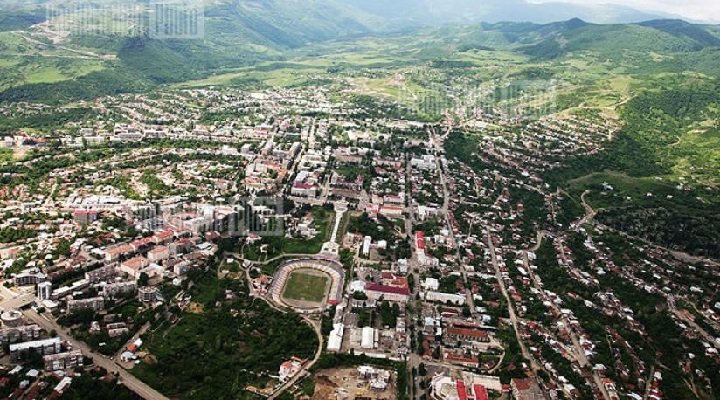
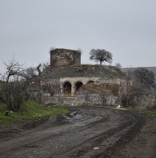
During the Soviet era, the Azerbaijani people continued to refer to the city informally by its historical name of Khankendi. Later on, the historical shreds of evidence proved that the main aim of Moscow was not to protect the territorial integrity of Azerbaijan but to create such a centre within the republic, which would serve the interests of Armenian nationalism and always be the problem for Azerbaijan. After the creation of the Nagorno-Karabakh Autonomous Oblast in 1923 until its official abolishment in 1991, the authorities of Khankendi, as well as all small and large institutions in the region were appointed among the ethnic Armenians. The history, cultural traditions, and ethnic composition of Khankendi and the whole autonomous region were cast aside, and the Armenian presence in the region was exaggerated. Although Khankendi was established as a resting place for the khans of the Karabakh Khanate, in the twentieth century it began to develop as a new Azerbaijani industrial and cultural centre.
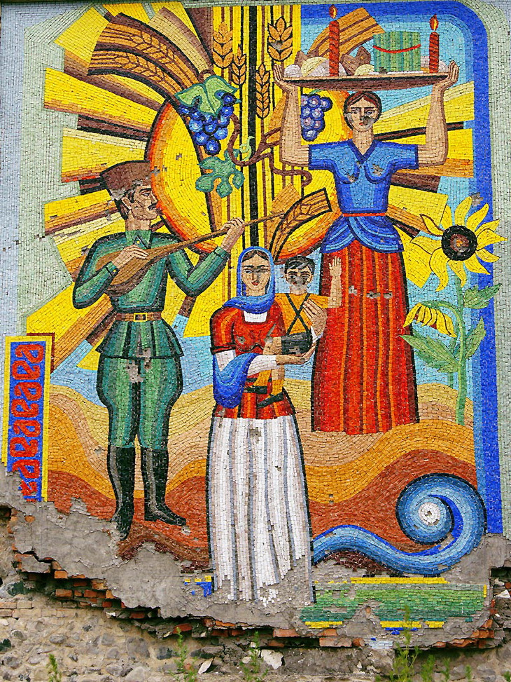
The light and food industry has been developed. Enterprises constructed in Khankendi produced more than half of the product of the Oblast. The industrial output of the province was producing more than half of the enterprises built-in Khakendi. Silk, shoe, carpet, textile factories, dairy enterprises, and winery operating in Khankendi were well-known in the South Caucasus. Electro-technology plant, furniture factory, construction materials factory occupied a worthy place in the domestic market.
Under Decree No.IX 837 of the Presidium of the Supreme Soviet of Azerbaijan SSR of May 15, 1978, the city center was moved from Stepanakert to workers settlement Askeran and Stepanakert district was called Askeran.
Under Decree No.1783-XI of the Presidium of the Supreme Soviet of Azerbaijan SSR of April 21, 1990, Karkijahan residential area of the city of Stepanakert was attributed to the category of urban-type settlements, and Karkijahan Settlement Soviet was established within Stepanakert City Soviet. Under the Law of the Azerbaijan Republic No.279-XII “On the Liquidation of Nagorno-Karabakh Autonomous Oblast of Azerbaijan” dated November 26, 1991, the historical name of the city Stepanakert was returned and renamed Khankendi.
Qaragol Interrepublics State Reserve was set up with the decision of the Council of Ministers dated November17, 1987. Garagol State …
The idea of establishing Aghdam Bread Museum, which is considered to be the second in the world after the Zurich …
The Khurshudbanu Natavan’s House is a historical and architectural monument of the 18th century located in the city of Shusha. …
Museum Mausoleum Complex of Molla Panah Vagif is located in Shusha, Azerbaijan. It was built in honor of Molla Panah …
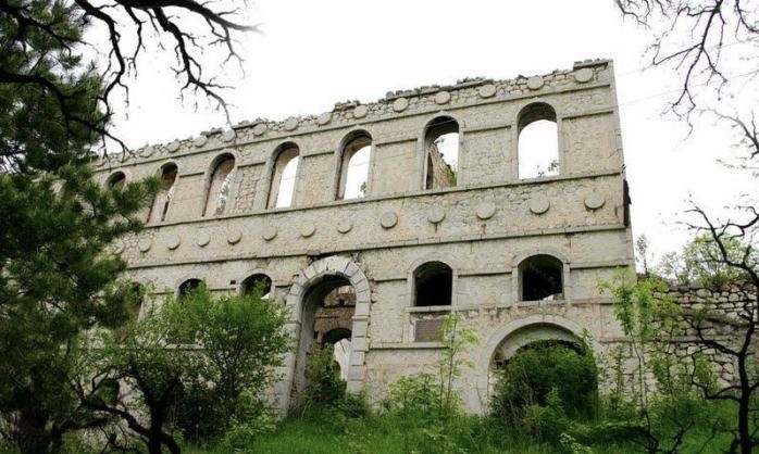
Garghabazar Caravanserai was built in 1681 at the hillside, in the center of Garghabazar village of Fuzuli district, 8 km …
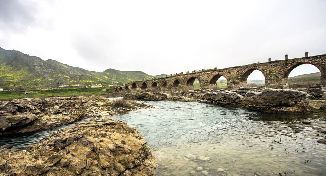
The Bridge belongs to the Arran architecture school. The first written source that mentioned the 15-arched Khudafarin Bridge belongs to …
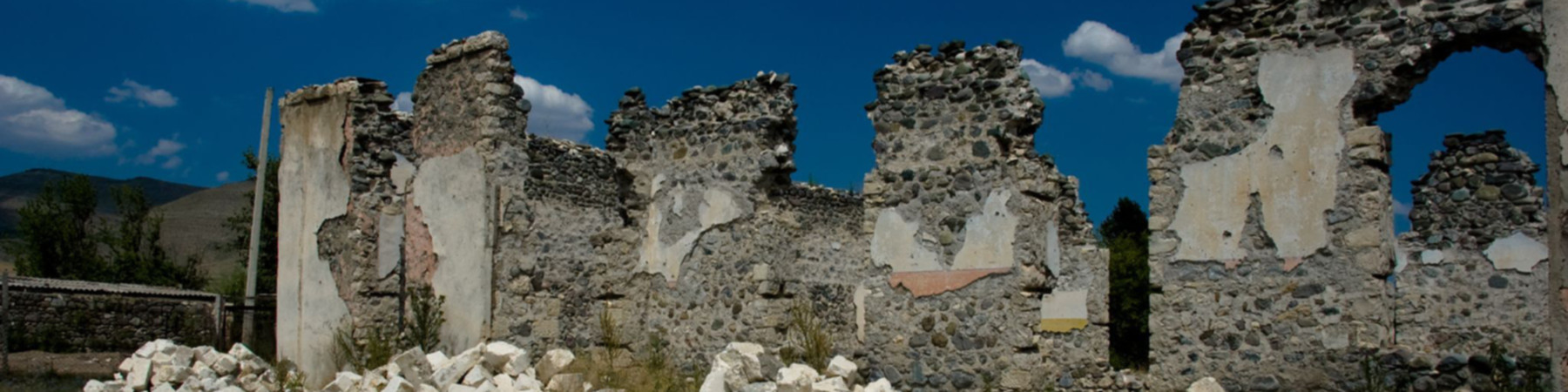
Armenia’s vandalism in Nagorno-Karabakh and seven surrounding regions affected not only the historical, cultural, and religious heritage of Islam but …

Jabrayil History-Ethnography Museum has been operating since 1953. Archaeological and ethnographic materials belonging to the history of the region, textiles, …

Khudavang, or Dedeveng, Monastery Complex is located in the Vang village of Kalbajar District, on the left bank of Tartar …
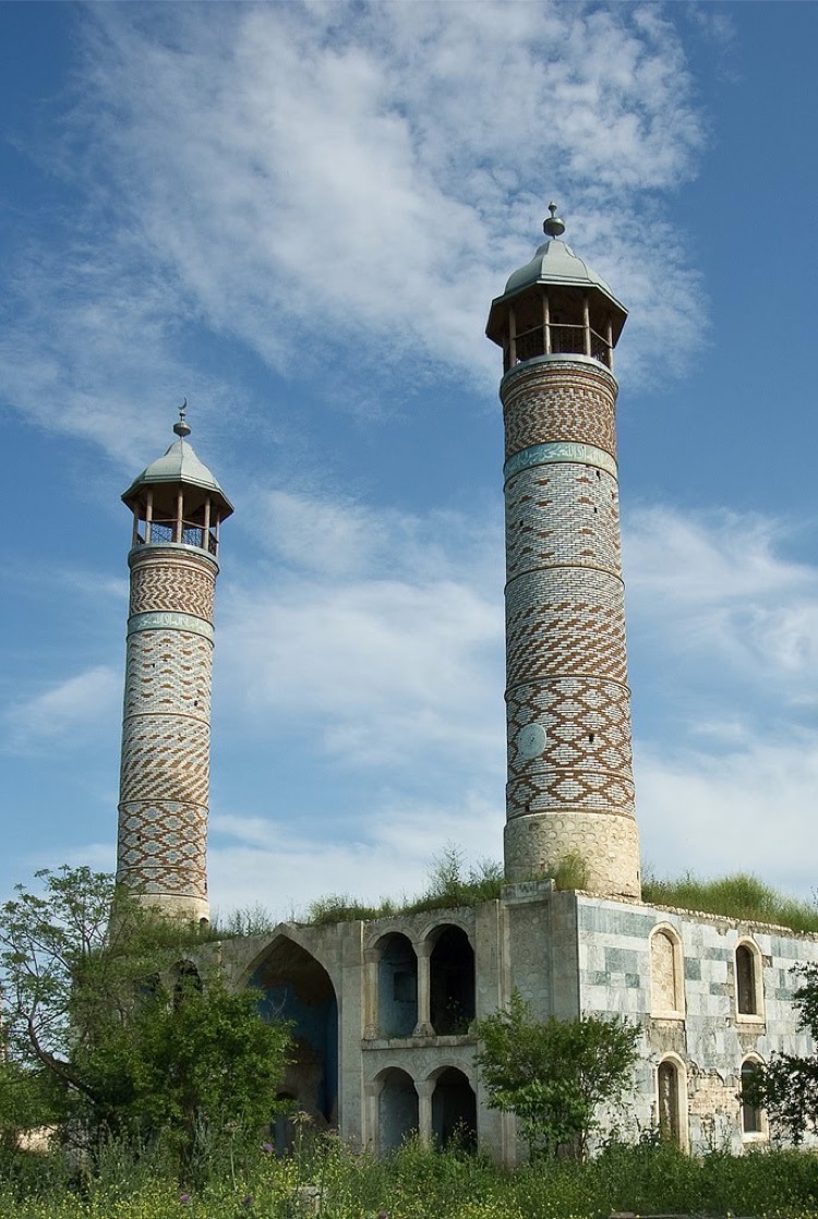
“The 19th century Aghdam Juma Mosque is perhaps the only structure that has withstood the years of neglect since the …