
of
of
of
Khojavand district was established based on Martuni and Hadrut districts on November 26, 1991, after the liquidation of Nagorno-Karabakh Autonomous Oblast. It is located in the southeastern part of the Karabakh Chain of Minor Caucasus. The area of the district is 1.46 thousand square kilometers with 42,4 thousand populations by 2013.
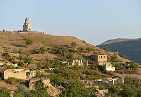
Khojavand combines 1 city (Khojavand), 2 big towns (Hadrut and Girmizi Bazar), and 81 villages. Its villages are – Shekher, Shikh Dursun, Dagdoshu, Edisha, Girmizigaya, Gochbayli, Tagaser, Vang, Aghkand, Akhullu, Arakul, Bunyadli, Jilan, Dashbashı, Zardanashen, Mushkapat, Kish, Kohna Taghlar, Yemishjan, Gargar, Kharkhan, Zavadıkh, Tagaverd, Chagaduz, Mulkudara, Arpaduzu, Azikh, Zogalbulag, Bina, Binadarasi, Sor, Boyuk Taghlar, Bulutan, Khirmanjig, Malikjanli, Jamiyyat, Chaylaggala, Arpagadik, Petrosashen, Chiraguz, Mammaddara, Tsakuri, Darakand Agjakand, Hakaku, Gagartsi, Guzumkand, Garazami, Mirikand, Avdur, Tugh, Atagut, Kuropatkin, Shahyeri, Dolanlar, Edilli, Agbulag, Dudukchu, Amiranlar, Gavahin, Agbulag, Guneykhirman, Chorakli, Guzeychartar, Guzeykhirman, Gunashli, Gushchular, Heshan, Khanoba, Khojavand, Kandkhurd, Garıtapa, Garadagli, Garakand, Muganli, Salakatin, Sos, Jutju, Susanlıg, Yenikand, Guneychartar.
Khojavand possessing a favorable geographical position and conditions. The district is neighboring Aghdam, Agjabadi, Fuzuli, Jabrail, Gubadli, Lachin, Shusha, Khojaly. Its name consists of 2 parts: ”Khoja” and “vand”. Khoja means “teacher” in turkish language. Vand means “child, descent” in Persian.
Khojavand is mostly a district of agriculture. Vine-growing, graining stock-raising are an important part of its economy. Mountainous rivers in the district along with beauty created favorable conditions for gardening and melon-plantation. From ancient times local people here have planted orchards and have been engaged in farming.
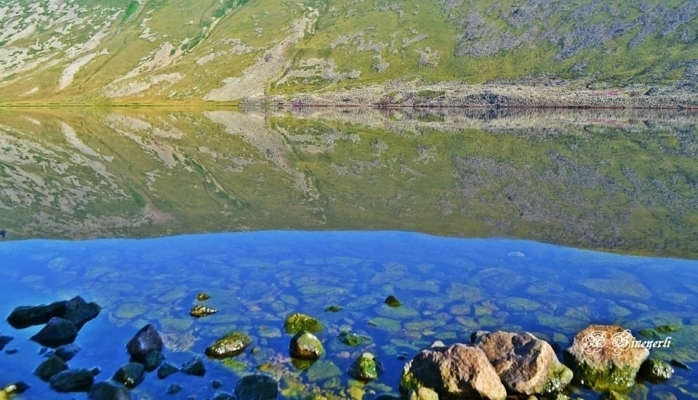
The district is located at the edge of Aghdam-Fuzuli road and is foothill plain. Relief is mostly mountainous. Height is approximately between 500 meters and 2725 meters (Big Kirs). There are tens of recreational zones in the district such as Bagirkhan, Girmizi Bazar, Mada spring, Baba spring, Balli Spring, etc.
As an ancient settlement place, Khojavand has unique natural resources, monuments, and resources that are suitable for the production of facing stone, limestone deposits of 989 thousand tons, suitable for limestone production, underground freshwater deposits of 90,33 thousand cubic meters a day.
Rivers such as Khonashenchay, Kondalanchay, Gozluchay, Guruchay, Chakhmagchay, Alichay, Atautchay, Binachay belong to Kura-Araz basin.
One East plane tree 1000 years old with a diameter of 600 centimeters, height of 25 meters, and one 2000 years old with a diameter of 600 centimeters, height of 25 meters in the town Girmizi Bazar of Khojavand were protected. In the village Garakand 100 years old zelkova trees, which were one of the species of III era with a diameter of 24 cm, a height of 12 meters were protected.
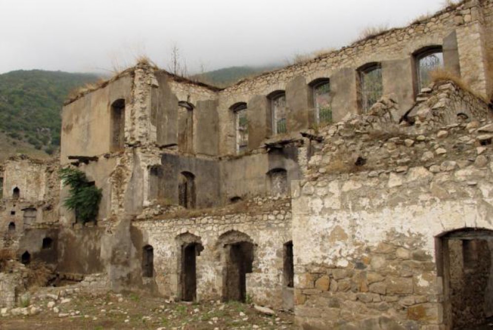
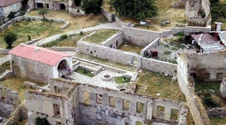
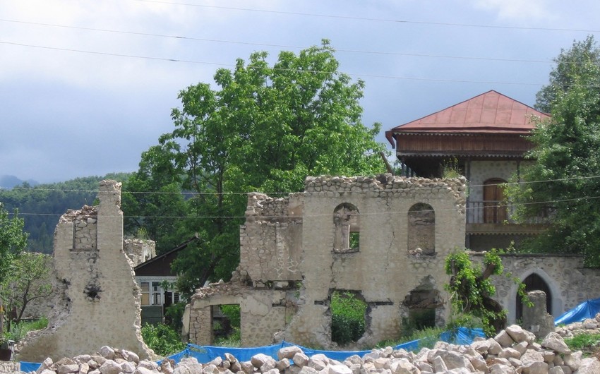
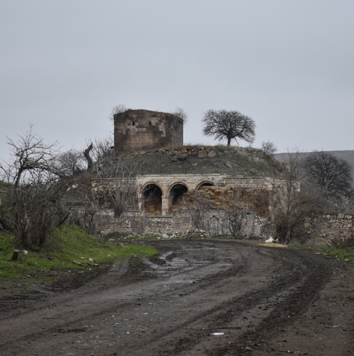
Khojavand was one of the first centers for Christianity in Azerbaijan, and there are many Christian monuments in the district dating from the 4th to the 19th centuries CE. It also had examples of Islamic architecture, such as tombs in the cemetery near Khojavand town.
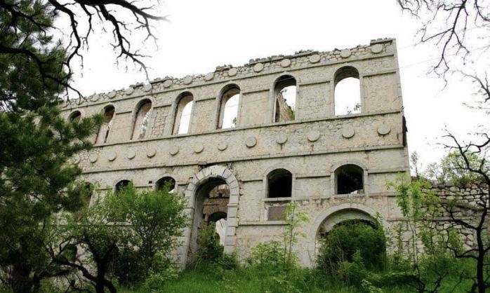
There are historical art and architectural monuments in Khojavand such as ancient cave “Taglar”, in the village Tug, castle “Ritish” remained from V-VIII centuries, “Argunesh” castle on the cliffs of mountain Argunesh, tomb “Rzagulu Bey” from XIII century, cupola “Ashigli Gosha”, temple “Alban” in the village Boyuk Taglar (1241) and temple “Girmizi” from X century. Beginning from February 1988 Khojavand gave 145 martyrs during the Karabakh war. Armenian military forces occupied Khojavand on October 2, 1992.
1. “Khojavand”, Virtual Karabakh. https://www.virtualkarabakh.az/en/post-item/27/106/khojavand.html.

Qaragol Interrepublics State Reserve was set up with the decision of the Council of Ministers dated November17, 1987. Garagol State …
The idea of establishing Aghdam Bread Museum, which is considered to be the second in the world after the Zurich …
The Khurshudbanu Natavan’s House is a historical and architectural monument of the 18th century located in the city of Shusha. …
Museum Mausoleum Complex of Molla Panah Vagif is located in Shusha, Azerbaijan. It was built in honor of Molla Panah …
Garghabazar Caravanserai was built in 1681 at the hillside, in the center of Garghabazar village of Fuzuli district, 8 km …
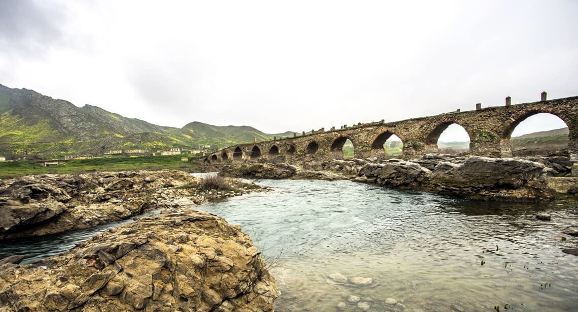
The Bridge belongs to the Arran architecture school. The first written source that mentioned the 15-arched Khudafarin Bridge belongs to …
Armenia’s vandalism in Nagorno-Karabakh and seven surrounding regions affected not only the historical, cultural, and religious heritage of Islam but …

Jabrayil History-Ethnography Museum has been operating since 1953. Archaeological and ethnographic materials belonging to the history of the region, textiles, …

Khudavang, or Dedeveng, Monastery Complex is located in the Vang village of Kalbajar District, on the left bank of Tartar …
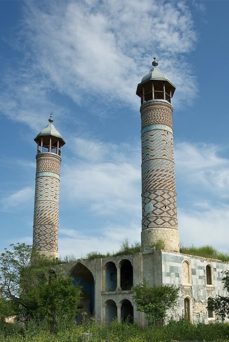
“The 19th century Aghdam Juma Mosque is perhaps the only structure that has withstood the years of neglect since the …