
of
of
of
The district of Zangilan is the administrative district of the Republic of Azerbaijan. It is located in the south-eastern part of the Minor Caucasus on the left bank of the Araz River. It is neighbor with the Republic of Armenia in the west and the north-west and with the Islamic Republic of Iran in the south. Its area is 710 km2; the population is 40,500. The central town is the city of Zangilan.
At the beginning of the nineteenth century, after the occupation of the South Caucasus by Tsarist Russia, the new territorial-administrative division was carried out there. Yelizavetpol province was created in 1868. It included Shusha, Yelizavetpol, and Zangazur provinces. According to a new division, the territory of the Zangilan district was included in Zangazur province.
In the documents that date back to 1925 Zangilan was shown as territory of Jabrayil province. In 1929, with the decision of TSFSR Nuvadi, Togud, Ernezir villages of Zangilan district, and in 1946, four thousand hectares of the forest area of the Republic of Azerbaijan was gifted to the Republic of Armenia.
As an independent Zangilan district was formed on August 8, 1930 and was granted a city status in 1967. At that time, Zangilan district had one City, 5 settlements (Agh oyug, Minjivan, Bartaz, Aghbend, Hekeri), 79 were villages. The villages are: Beshdeli, Genlik, Kechikli, Malatkeshin, Sarigishlag, Birinji Aghali, Ikinji Aghali, Uchunju Aghali, Birinji Alibeyli, Khumarli, Ikinci AlIbəyli, Sarıl, Bartaz, Qarqulu, Tatar, Tiri, Shafibayli, Mashadi Ismayilli, Sharikan, Burunlu, Yukharı Yemezli, Rebend, Yenikend, Zangilankend, Jahangirbeyli, Turabad, Veligulubeyli Janbar, Aghkend, Dereli, Gungishlag, Gazanchi, Pirveys, Yukhari Chopdere, Baharlı, Dallakli, Sobu, Boyuk Giletagh, Aladin, Dere Giletagh, Mirzehesenli, Udgun, Samli, Venedli, Hajalli, Seyidler, Vejneli, Aghbend, Amirkhanli, Girag Mushlan, Melikli, Mughanli, Khurama, Mughanli, Sharifan, Isgenderbeyli, Aghakishiler, Aghbis, Memmedbeyli, Babayli, Ordekli, Garadere, Garagoz, Rezdere, Kolluqışlaq, Shatariz, Shayifli, Ashaghi Gayali, Qaragol, Icheri Mushlan, Taghli, Yusifler, Ashaghı Yeməzli, Orta Yemezli, Guyuderə Kheshtab, Sarili Kheshtab, Zerneli, Havali, Negefler.
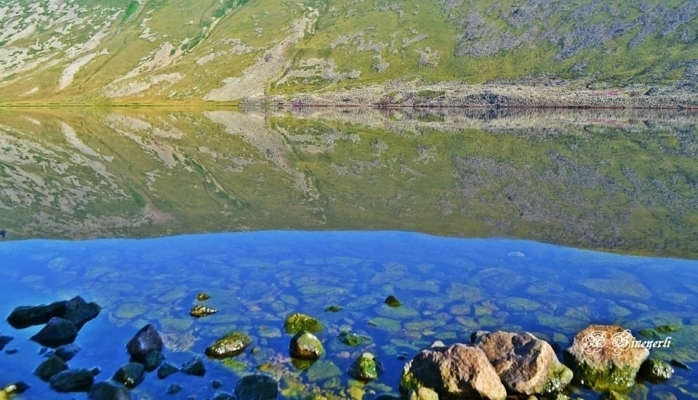
Zangilan is a district with fascinating beauty, rich with flora and fauna thanks to its geographical position, soil, and climate. The territory is within the scope of medium and low mountains, and it has the complex fragmented structure of the surface. From the north-west area, the Bargushad ridge (at 1304 meters above sea level Susan Mount.) forms “Agh oyuq” (White hole) plain (400-600 meters above sea level) between the Bazarchay and Okhju Rivers. From the north-east Karabakh ridge, the descending slope passes the hilly rivers Hakari and Araz and reaches the Gayan Lake. In the west, at the edge of Megri (Mehri-Guney) ridge Sukrataz mountain ridge (2270 meters high above sea level) is located.
Plane-tree is the symbol of Zangilan. This proud and beautiful tree has been under the protection of men from time immemorial. There have been created the Basutchay National reserve in the district just because of the plane-tree groves.
Apart from being a territory with enormous amounts of natural beauty, Zangilan was considered one of the most ancient settlements in Azerbaijan. The caves in Susan and Asgulum Mountains testify to the existence of primitive human beings in this area. During the archeological excavations in Zangilan, pitcher graves, one of the grave forms spread in Azerbaijani territories in the middle of the I millennium ВС, were found in the place called “Martyr Mahammad” between the Yukhary and Orta Yemazli villages. It should be mentioned that this form of burial in Azerbaijan continued up to the 7th – 8th centuries AD.
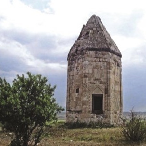
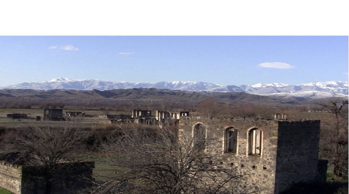
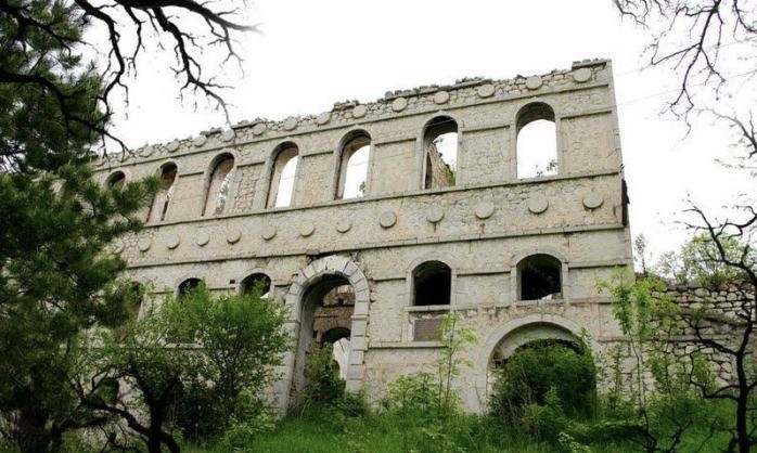
As a result of the archeological excavations in 1974 and 1979 in the territory of Zangilan district, an ancient residential area, Shahri-Sharifan, was discovered. According to medieval sources, Sharifan was located at the crossroads of important trade routes, like Barda-Dvin and Ardabil-Nakhchivan. There are also very interesting archeological sights in Zangilan such as the towers of the 6th century in settlements Bartaz and Kechikli.
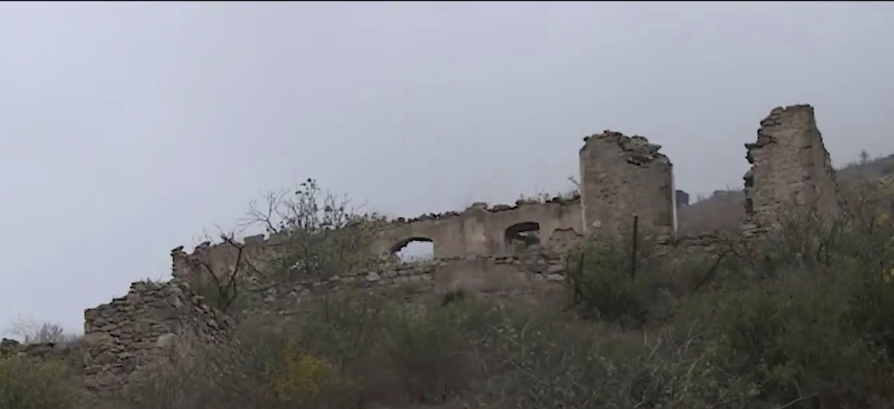
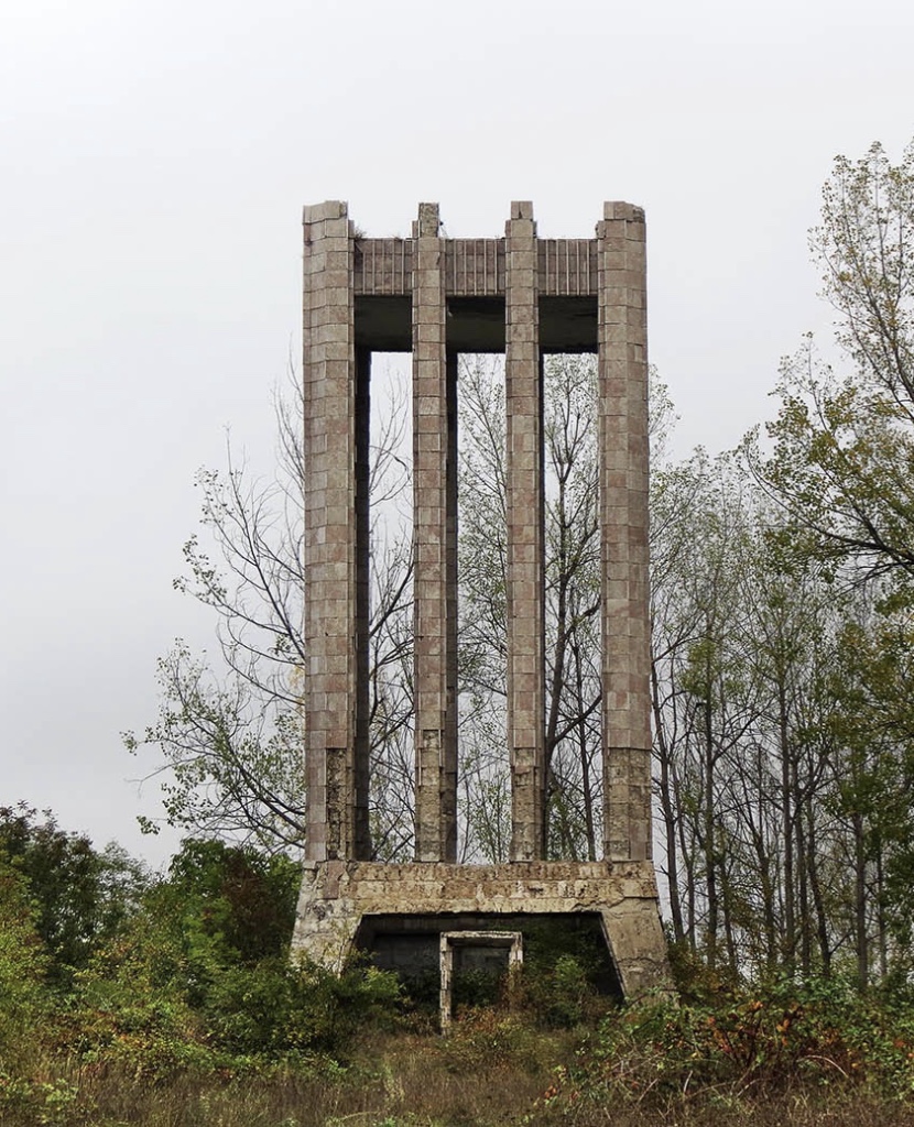
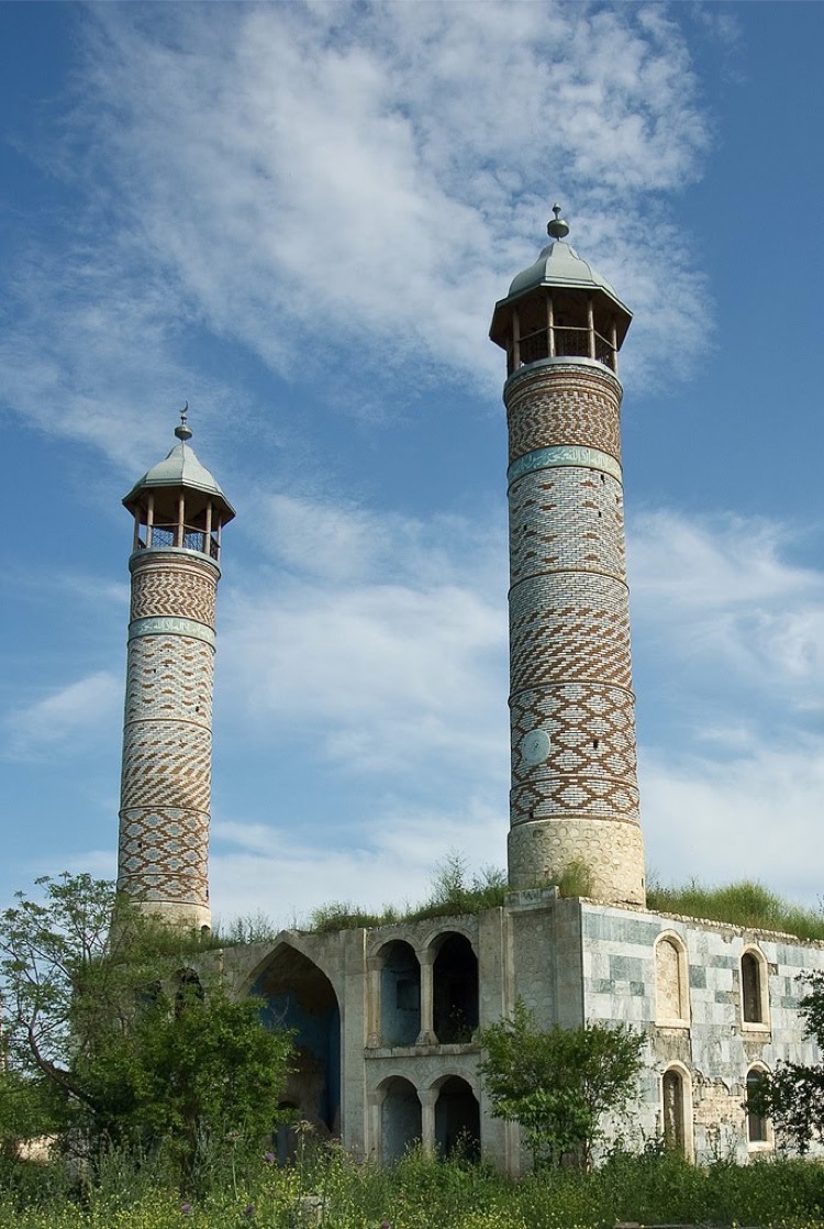
Besides archeological monuments like ancient residential areas, cemeteries, and pitcher graves, Zangilan also had different architectural monuments. These included sites such as the “Maiden tower” of the 12th century in Amirkhanli village, the round tower of unknown age in Hajalli village, the 14th-century octagonal tomb in Mammadbayli village, the 14th-century crypt in Yenikand village, the Albanian church in Ashaghi Yemazli village, and various mosques and castles.
That is why, prior to the occupation there were hundreds of exhibits in the museums situated in the city centre, which reflected our people’s culture, lifestyle and way of life from remote past till today.
At the beginning of the century, the territory of the present town centre consisted of local beys’ paddy farms and their residences. There were a lot of districts in Zangilan. They were: Cheshmegozlu, Kohne Pirchiyan, Mesjid Duzu, Shaftali Deresi, Kurdezi, Deresi, Baghirsag Dere, Munjuglu Dere, Rayshelik (the place where the silk office was located), etc.
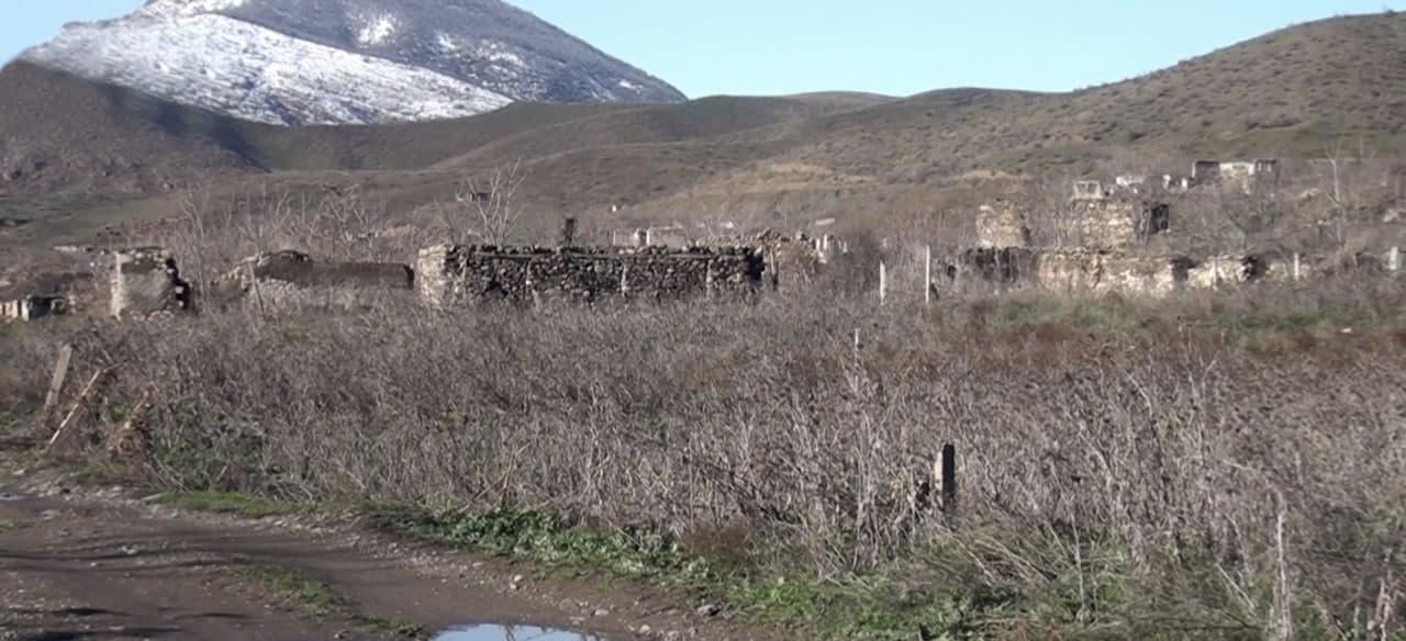
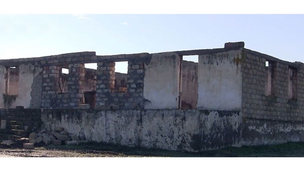
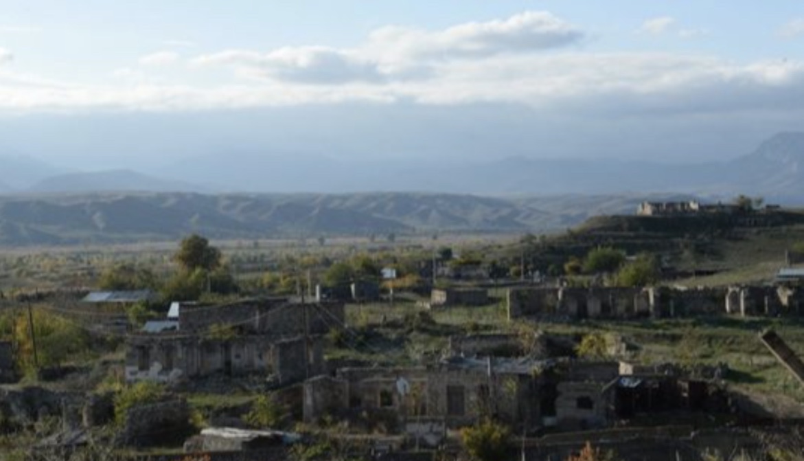
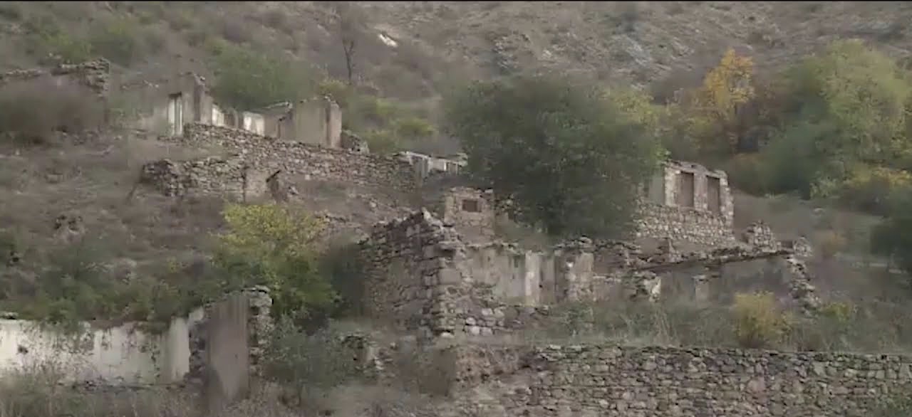
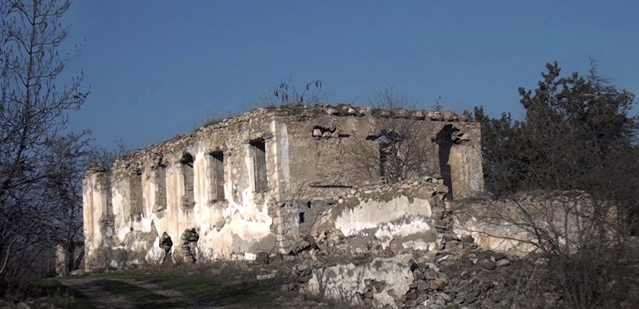
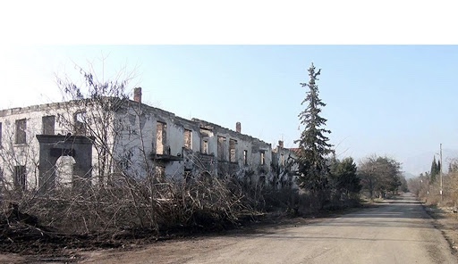
The economic development of the Zangilan district dates back to the years of the Soviet Union. Before the occupation, the district was engaged in the tobacco-growing and viticulture. Cattle-breeding, silkworm-breeding, and wheat-growing were developed. The district was occupied by the Armenian Armed Forces on October 27, 1993.
Before occupation, the district had a population of 32.6 thousand people. Before the occupation, there were 10453 dwelling houses, 28200 subsidiary buildings, 195 administrative buildings, 870 farm subsidiary buildings, 128 cultural centers, 123 educational institutions, technical schools, 64 health care facilities, Gotursu health centre, 80 communication institutions, 7 mobile auto clubs, 21 film projectors, 2 History-Ethnography museums, 142 shopping centers, 49 public-catering establishments, 2 wine mills, a cannery, a textile factory, a brick factory, a bread-making plant, a gravel plant, 2 asphalt plants, Yazi Duzu water pumping station complex, 8 railway stations, Minjivan Depot, poultry farm, cattle fattening complex, 3400 hectares of vineyards, 6 artificial water basins in Zangilan.
After the occupation of Fuzuli and Jabrail districts, the population of Zangilan during 67 days lived and fought under the siege. On October 25-29, 1993, they fought till the last drop of blood and crossed the Araz River, settled in the territory of the Islamic Republic of Iran and different districts of Azerbaijan.
On October 20, 2020, the Glorious Army of Azerbaijan ended the 27-year Armenian occupation of the city of Zangilan.
Qaragol Interrepublics State Reserve was set up with the decision of the Council of Ministers dated November17, 1987. Garagol State …
The idea of establishing Aghdam Bread Museum, which is considered to be the second in the world after the Zurich …
The Khurshudbanu Natavan’s House is a historical and architectural monument of the 18th century located in the city of Shusha. …
Museum Mausoleum Complex of Molla Panah Vagif is located in Shusha, Azerbaijan. It was built in honor of Molla Panah …
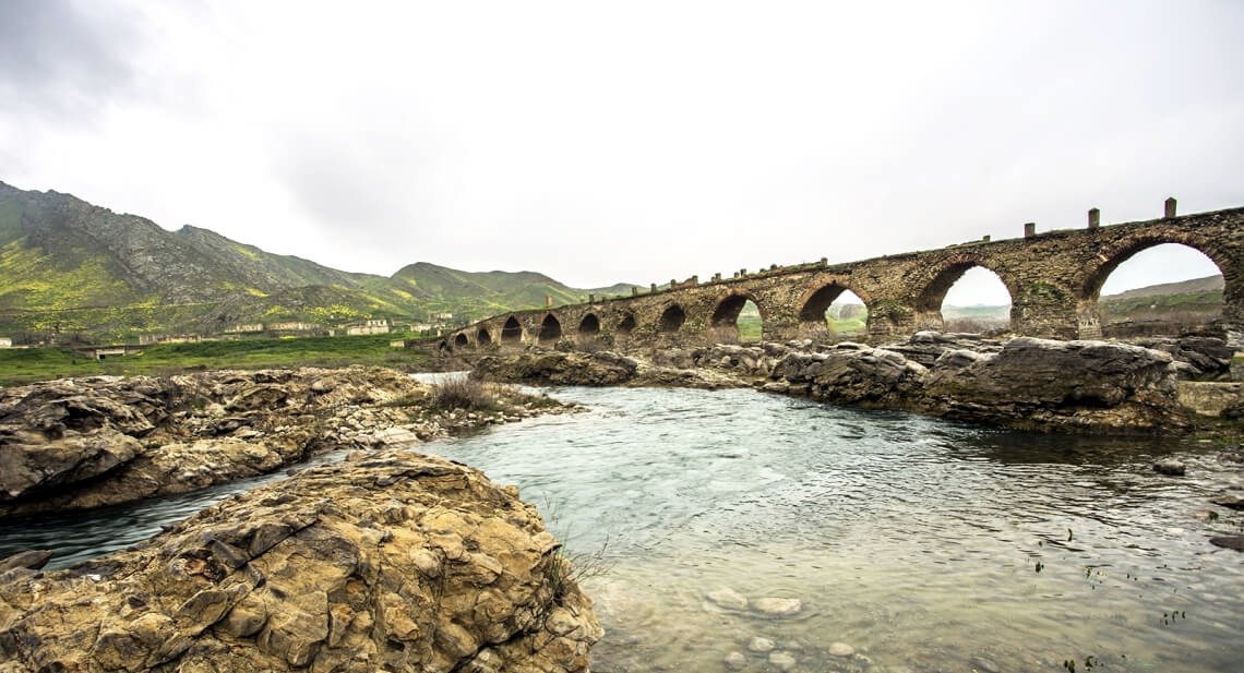
The Bridge belongs to the Arran architecture school. The first written source that mentioned the 15-arched Khudafarin Bridge belongs to …
Garghabazar Caravanserai was built in 1681 at the hillside, in the center of Garghabazar village of Fuzuli district, 8 km …
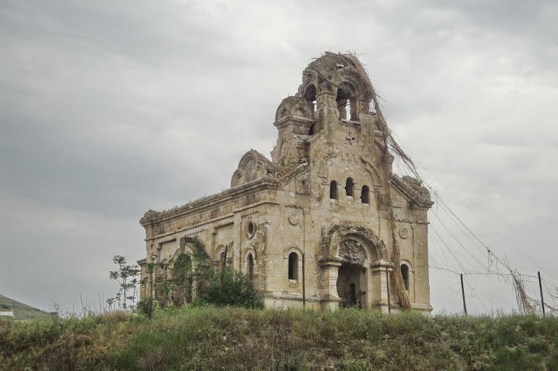
Armenia’s vandalism in Nagorno-Karabakh and seven surrounding regions affected not only the historical, cultural, and religious heritage of Islam but …

Jabrayil History-Ethnography Museum has been operating since 1953. Archaeological and ethnographic materials belonging to the history of the region, textiles, …

Khudavang, or Dedeveng, Monastery Complex is located in the Vang village of Kalbajar District, on the left bank of Tartar …
“The 19th century Aghdam Juma Mosque is perhaps the only structure that has withstood the years of neglect since the …